Explore the Binjareb-Peel Geotrail Drive

Members of the WA State Government, Aboriginal elder George Walley and the team from Geoparks Australia at the end of the viewing platform at the Lake Clifton Thrombolites. Image credit: Peel Development Commission/Overland Media.
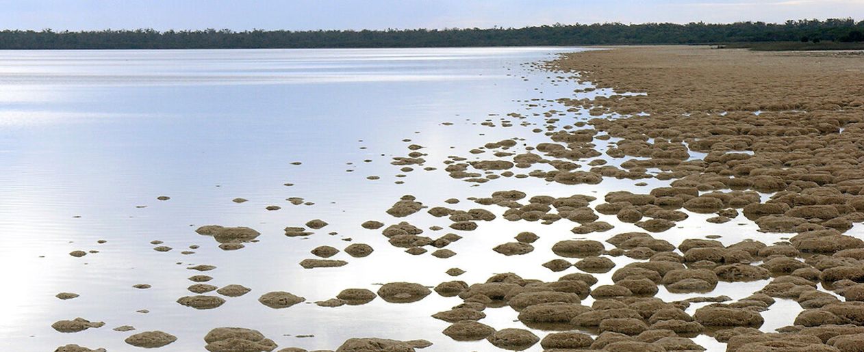
The living, rock-like structures known as thrombolites on the shores of Lake Clifton in the Yalgorup National Park are one of the outstanding features along the recently launched Binjareb-Peel Geotrail Drive.
New interpretive signage along the trail, extending from Mandurah to Lake Clifton and out to Pinjarra and Waroona, enables visitors to scan a QR code and learn more about the geology of the area (Bindjareb Noongar Country), its flora and fauna and cultural significance.
The Peel Development Commission worked in partnership with Dr Alan Briggs, Professor Ross Dowling AM and Wendy Dowling AM from Geoparks WA and Bindjareb elders to bring this project to life. (Professor Dowling and Wendy Dowling are both Park Ambassadors.)
Support was also received from the Department of Biodiversity, Conservation and Attractions, surrounding local governments, Salt and Bush Eco Tours, Trails WA and Geological Survey of WA, all of whom have been involved in making this important project a success.
Including the thrombolites, the largest known occurrences in the southern hemisphere, there are twelve sites of interest along the geotrail.
To download the map to the drive trail, please click here or access the google map of the trail here


